Japan Aerospace Exploration Agency Earth Observation Research Center ALL RIGHTS RESERVED.

|
|
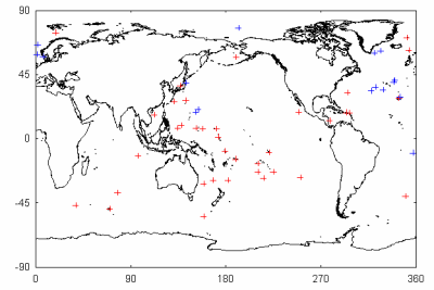
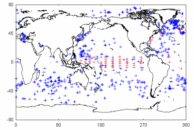
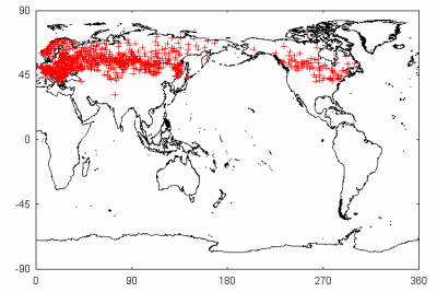
Operational ground observations are being performed by worldwide operational agencies and science programs. These existing data are utilized for validating AMSR/AMSR-E geophysical products. Collocated AMSR/AMSR-E footprints with ground observations in space and time (match-up dataset) are
operationally generated and used for the validation project. In addition, inter-sensor or inter-satellite comparisons are also useful.
|
||||||||
|
|
||||||||