|
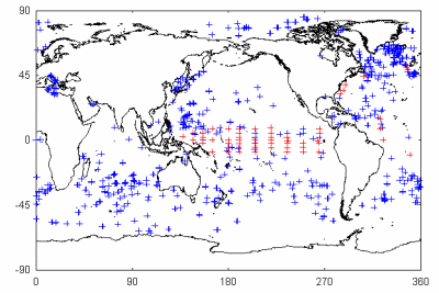
Observation data from global buoys and ships are utilized to validate sea surface temperature and sea surface wind speed. These observations are maintained by worldwide operational agencies and science programs such as the Tropical Atmosphere Ocean (TAO) Project. The figure below shows an example of distribution of observations by moored buoys, drifting buoys, and ships. These data should be used carefully for validation due to the differences of measurement characteristics (measurement height of wind speed, data quality, etc.)
|