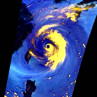
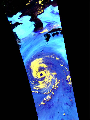
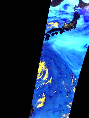
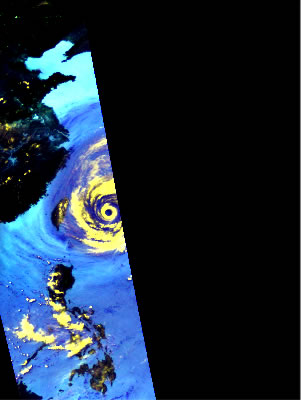
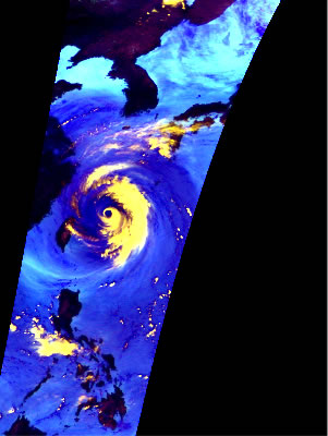
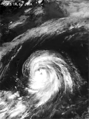
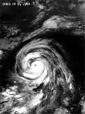
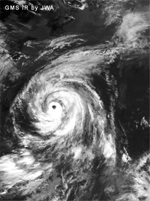
Images of Typhoon No.5 (Rammasun) in 2002 were obtained by the Advanced Microwave Scanning Radiometer for EOS (AMSR-E) developed by JAXA. AMSR-E is the instrument onboard NASA's Aqua spacecraft launched in May 2002. The images in the middle are from the four consecutive observations during July 2-4, 2002 Japan Standard Time (JST) with an interval of approximately 12 hours. The top image is a close-up view of the observation in July 4, 2:26 a.m. JST. All the top and middle images are color composites using brightness temperatures of 89.0-GHz (both vertical and horizontal polarization) and 23.8-GHz (vertical polarization) channels. Over the oceans, possible strong precipitation areas are highlighted by bright yellow; colors varying from aqua to dark blue correspond to increases of water vapor and clouds. AMSR-E observes Japan area twice a day (early-afternoon and midnight), and so provides sequential observations like in the middle figures. It can be seen that the typhoon moved toward the north with the precipitation areas getting organized in time. As of July 2, the typhoon was located out of the observation areas of Japanese ground rain radars. In the circumstances like this, satellite observations provide very important information.
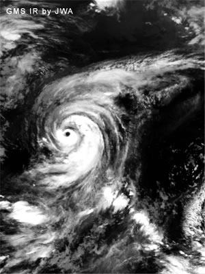
Corresponding cloud images in the bottom are from the infrared observations by the Japanese geostationary meteorological satellite "Himawari" (GMS-5). By comparing the images of microwave and infrared observations, it is clear that the microwave measurement by AMSR-E can provide frequent observations of precipitation areas and land surfaces through clouds, while the infrared measurement by GMS-5 is not able to observe underlying features due to the extended clouds around the typhoon.