JAXA/EORC Real-Time Monitoring
JAXA/EORC Real-Time Monitoring

 You can access to online archive of images, movies and data of tropical cyclones observed by TRMM/Aqua/Midori-II satellites.
| DPR/GMI (GPM) | |||||||||||||||||
|---|---|---|---|---|---|---|---|---|---|---|---|---|---|---|---|---|---|
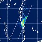
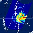
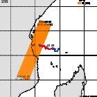
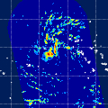
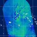
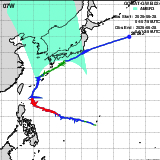
| DPR(KuPR) Image | GMI Image | Observation Area |
 04E(FOUR_E)
|
||||||||||||||
|
|
|
|||||||||||||||
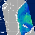
| AMSR3 (GOSAT-GW) | |||||||||||||||||
| Precipitation |
All-weather Sea Surface Wind Speed | Observation Area |
04E(FOUR_E)
|
||||||||||||||
|
|
|
|||||||||||||||
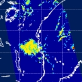
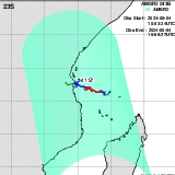
| AMSR2 (GCOM-W) | |||||||||||||||||
| Precipitation |
All-weather Sea Surface Wind Speed | Observation Area |
04E(FOUR_E)
|
||||||||||||||
|
|
|
|||||||||||||||