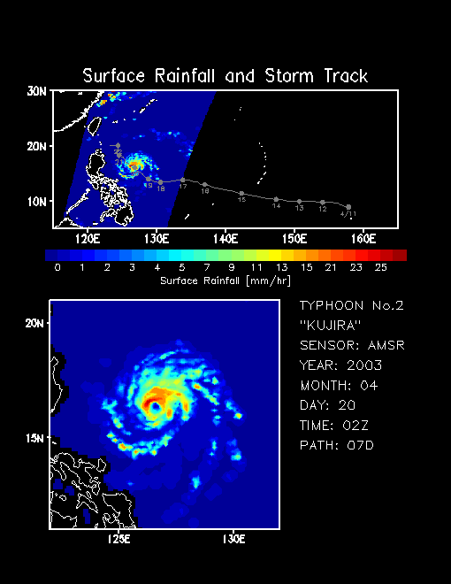
Typhoon No. 2, "KUJIRA", was tracked by
AMSR and
AMSR-E from April 12 to 21, 2003 (10 days). KUJIRA means whale in Japanese. KUJIRA originated in the deep tropics over the central Pacific and moved from east to west in the direction of the Philippine islands, dumping heavy rain. Gray dots (lines) in the top panel show the positions of the typhoon at 0000Z (UT) on each date (track) (information of typhoon track was provided by the Japan Weather Association). Rainbow colors indicate surface rainfall rate. The temporal variation of the rainfall distribution clearly indicates that the rainfall system associated with the typhoon was organizing, developing, and decaying. The bottom panel shows a close-up view of the rainfall distribution near the typhoon center. Combining
AMSR (observing local time at 10:30 a.m. and p.m.) and
AMSR-E (1:30 a.m. and p.m.) ensures very frequent quantitative measurements. Rainfall rates are being validated.


 Related Links