 Apr. 1, 2003
Wakasa Solid Precipitation Experiment 2003
The solid precipitation experiment for AMSR/AMSR-E validation was conducted in the Fukui area from January 12 to February 5, 2003. The Dual Polarization Doppler Radar was installed in Mikuni-machi, and other ground-based instruments were installed at Fukui airport.
This experiment sought to upgrade the AMSR/AMSR-E precipitation algorithm, with special focus on a solid precipitation retrieval algorithm.
 |
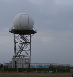 |
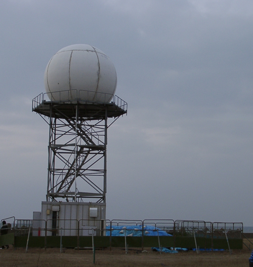
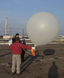
| Ground-based observation was performed at the Fukui Airport using an upper-air sounding system, Microwave Radio Meter, Micro Rain Radar, Auto Weather station, Snow Particle Observation System, etc. | The Dual Polarization Doppler Radar transmits and receives both horizontal and vertical polarization signals. Therefore, it is able to measure both the horizontal and vertical dimensions of precipitation particles. This information is useful for improving radar estimates of precipitation type and rate. This radar has an observation range of 120km. |
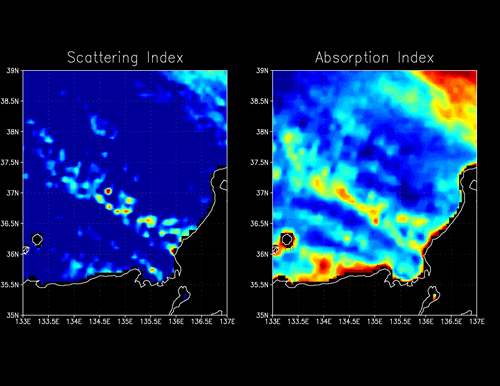
The left figure is the scattering index retrieved from 89GHz data. Colors varying from blue to red correspond to increasing scattering. The right figure is the absorption index retrieved from 37GHz data. Colors varying from blue to red represent increasing absorption.
These figures are useful for retrieving solid precipitation rates, such as for snow. The snow shown in the
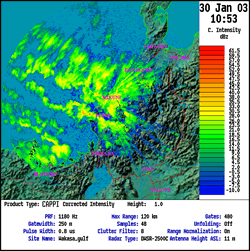
AMSR images correlates well with the heavy snow shown in the rain image retrieved from radar (below right).
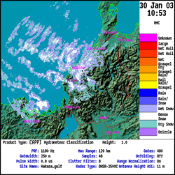
The left image shows radar reflectivity intensities. The intensity is related to the precipitation rate, with colors varying from blue to red corresponding to increasing intensity of radar reflectivity. Cold outbreaks from the Japan Sea dominated, and snowfall occurred. The right figure presents precipitation types such as snow, graupel, drizzle and rain. In this image, precipitation types include dense snow (white) and dry snow (light blue).
Continued analysis of ground-based observation data and AMSR/AMSR-E data is needed for further studies on the solid precipitation retrieval algorithm. Improving the AMSR/AMSR-E solid precipitation retrieval algorithm will provide global precipitation data sets.
- Acknowledgments
- We are grateful for the cooperation of the personnel of the Fukui Airport Construction Planning Section and the Hokuriku Electric Power Company.
Earth Observation Research and application Center, Japan Aerospace Exploration Agency
JAXA EORC
ALL RIGHTS RESERVED.