 Jan. 30, 2003
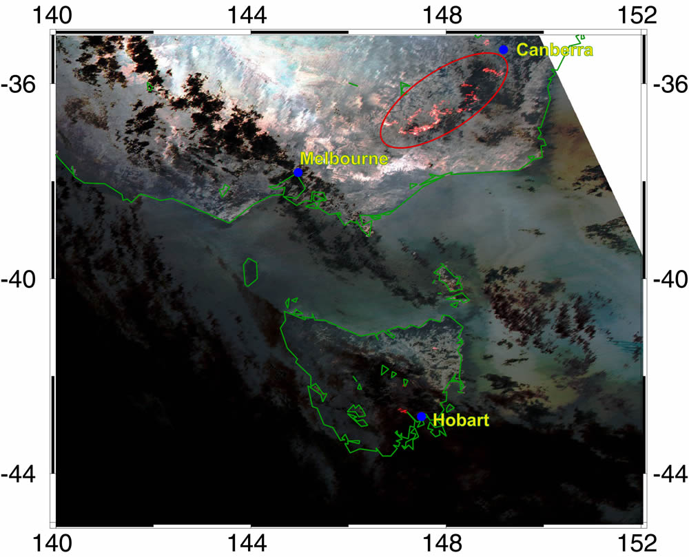
Bushfires in Southeast Australia on January 25, 2003
Global Imager (GLI) captured severe bushfires in Southeast Australia (New South Wales and Victoria State) at about 13:20UT on January 25, 2003. An infrared channel (3.715µm) of GLI can detect high temperature at the surface. Red portions on the figure represent high temperature at the surface, which can be corresponding to bushfires. In addition observations during the day can show spread of smoke from bushfires. Thus, broad-view and multi-spectrum observations from GLI can reveal situations of severe natural disasters.
Earth Observation Research and application Center, Japan Aerospace Exploration Agency
JAXA EORC
ALL RIGHTS RESERVED.