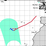
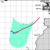
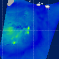
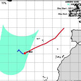
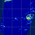
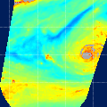
Hurricane OPHELIA(17L)
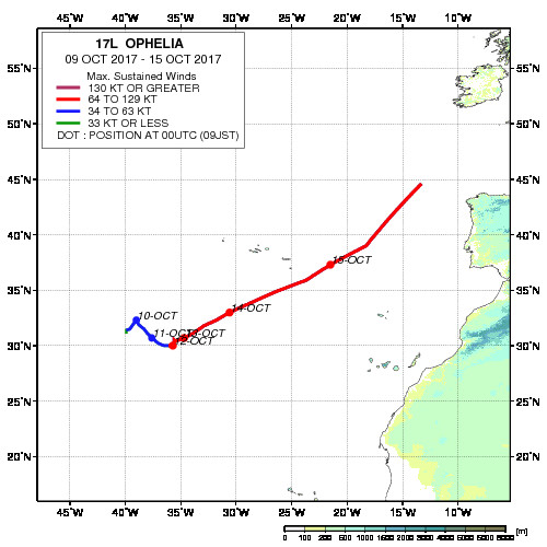
Track Image
Period :Oct 09,2017 - Oct 15,2017
Region :North Atlantic
Maximum Sustained Winds :100 kt (Category 3)
Number of GCOM-W/AMSR2
Observation :
6
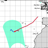
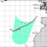
Track Chart(JPEG, 500x500)
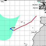
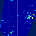
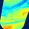
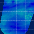
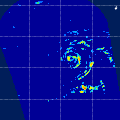
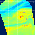
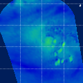
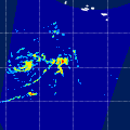
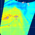
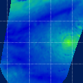
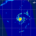
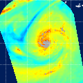
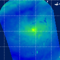
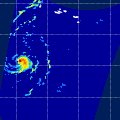
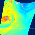
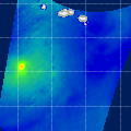
Observation AreaAMSR2
Precipitation
AMSR2
Total Precipitable Water
AMSR2
All-weather Sea Surface Wind Speed
InformationGSMaP
Date/Time:Oct 10,2017 04:49 (UTC)
Satellite/Sensor:GCOM-W/AMSR2
Path Number226D
Lat/Lon:24.5N-48.6N
29.8W-54.4W
DownLoad:L1B(V02) SGPRC(V03) SGTPW(V02) RGASW(V03)
GSMaP
Date/Time:Oct 10,2017 15:49 (UTC)
Satellite/Sensor:GCOM-W/AMSR2
Path Number089A
Lat/Lon:13.4N-37.4N
28.7W-50.2W
DownLoad:L1B(V02) SGPRC(V03) SGTPW(V02) RGASW(V03)
GSMaP
Date/Time:Oct 11,2017 03:55 (UTC)
Satellite/Sensor:GCOM-W/AMSR2
Path Number217D
Lat/Lon:20.9N-45.0N
17.7W-41.2W
DownLoad:L1B(V02) SGPRC(V03) SGTPW(V02) RGASW(V03)
GSMaP
Date/Time:Oct 12,2017 04:37 (UTC)
Satellite/Sensor:GCOM-W/AMSR2
Path Number224D
Lat/Lon:22.3N-46.4N
27.8W-51.7W
DownLoad:L1B(V02) SGPRC(V03) SGTPW(V02) RGASW(V03)
GSMaP
Date/Time:Oct 12,2017 15:37 (UTC)
Satellite/Sensor:GCOM-W/AMSR2
Path Number087A
Lat/Lon:12.7N-36.7N
25.4W-46.8W
DownLoad:L1B(V02) SGPRC(V03) SGTPW(V02) RGASW(V03)
GSMaP
Date/Time:Oct 13,2017 03:42 (UTC)
Satellite/Sensor:GCOM-W/AMSR2
Path Number215D
Lat/Lon:21.4N-45.4N
14.4W-38.0W
DownLoad:L1B(V02) SGPRC(V03) SGTPW(V02) RGASW(V03)
GSMaP
JAXA/EORC
Japan Aerospace Exploration Agency Earth Observation Research Center
JAXA/EORC
New System