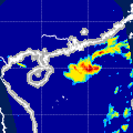
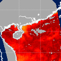
| Observation Area | PR 3D | KuPR/PR/VIRS
Image | AMSR-E/AMSR
Precipitation | AMSR-E/AMSR
Total Precipitable Water | Information | GSMaP |
|---|
 |  |  |  onClick='toggleDiv(event,this.src,"imageA");' onClick='toggleDiv(event,this.src,"imageA");' |  |
|
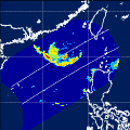
GSMaP |
 |  |  |  onClick='toggleDiv(event,this.src,"imageA");' onClick='toggleDiv(event,this.src,"imageA");' | |
|
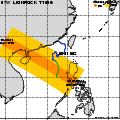
GSMaP |
 | | |  |  |
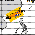
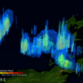
| Date/Time: | Aug 27,2010 18:13 (UTC) |
| Satellite/Sensor: | Aqua/AMSR-E |
| Path Number | 122MD |
| Lat/Lon: | 9.2N-28.6N
104.2E-122.1E |
| DownLoad: | P01B(V06) P2AP0(V06) P2WV0(V06) |
|
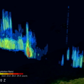
GSMaP |
 |  |  |  onClick='toggleDiv(event,this.src,"imageA");' onClick='toggleDiv(event,this.src,"imageA");' | |
|
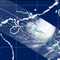
GSMaP |
 |  |  |  onClick='toggleDiv(event,this.src,"imageA");' onClick='toggleDiv(event,this.src,"imageA");' | |
|
GSMaP |
 |  |  |  onClick='toggleDiv(event,this.src,"imageA");' onClick='toggleDiv(event,this.src,"imageA");' | |
|
GSMaP |
 | | |  |  |
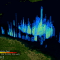
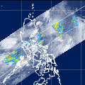
| Date/Time: | Aug 29,2010 05:49 (UTC) |
| Satellite/Sensor: | Aqua/AMSR-E |
| Path Number | 225MA |
| Lat/Lon: | 6.9N-26.4N
104.3E-121.9E |
| DownLoad: | P01B(V06) P2AP0(V06) P2WV0(V06) |
|
GSMaP |
 |  |  |  onClick='toggleDiv(event,this.src,"imageA");' onClick='toggleDiv(event,this.src,"imageA");' | |
|
GSMaP |
 | | |  |  |
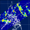
| Date/Time: | Aug 29,2010 17:59 (UTC) |
| Satellite/Sensor: | Aqua/AMSR-E |
| Path Number | 120MD |
| Lat/Lon: | 14.7N-34.2N
108.4E-127.0E |
| DownLoad: | P01B(V06) P2AP0(V06) P2WV0(V06) |
|
GSMaP |
 |  |  |  onClick='toggleDiv(event,this.src,"imageA");' onClick='toggleDiv(event,this.src,"imageA");' | |
|
GSMaP |
 |  |  |  onClick='toggleDiv(event,this.src,"imageA");' onClick='toggleDiv(event,this.src,"imageA");' | |
|
GSMaP |
 | | |  |  |
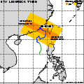
| Date/Time: | Aug 31,2010 05:37 (UTC) |
| Satellite/Sensor: | Aqua/AMSR-E |
| Path Number | 223MA |
| Lat/Lon: | 6.8N-26.2N
107.4E-125.1E |
| DownLoad: | P01B(V06) P2AP0(V06) P2WV0(V06) |
|
GSMaP |
 |  |  |  onClick='toggleDiv(event,this.src,"imageA");' onClick='toggleDiv(event,this.src,"imageA");' | |
|
GSMaP |
 | | |  |  |
| Date/Time: | Aug 31,2010 17:47 (UTC) |
| Satellite/Sensor: | Aqua/AMSR-E |
| Path Number | 118MD |
| Lat/Lon: | 15.3N-34.8N
111.6E-130.4E |
| DownLoad: | P01B(V06) P2AP0(V06) P2WV0(V06) |
|
GSMaP |
 |  |  |  onClick='toggleDiv(event,this.src,"imageA");' onClick='toggleDiv(event,this.src,"imageA");' | |
|
GSMaP |
 |  |  |  onClick='toggleDiv(event,this.src,"imageA");' onClick='toggleDiv(event,this.src,"imageA");' | |
|
GSMaP |
 |  |  |  onClick='toggleDiv(event,this.src,"imageA");' onClick='toggleDiv(event,this.src,"imageA");' | |
|
GSMaP |