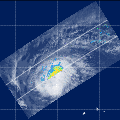
| Observation Area | PR 3D | KuPR/PR/VIRS
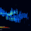
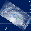
Image | AMSR-E/AMSR
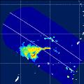
Precipitation | AMSR-E/AMSR
Total Precipitable Water | Information | GSMaP |
|---|
 |  |  |  onClick='toggleDiv(event,this.src,"imageA");' onClick='toggleDiv(event,this.src,"imageA");' |  |
|
GSMaP |
 | | |  | 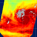 |
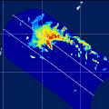
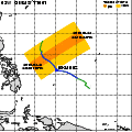
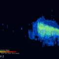
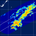
| Date/Time: | Mar 22,2010 16:25 (UTC) |
| Satellite/Sensor: | Aqua/AMSR-E |
| Path Number | 104MD |
| Lat/Lon: | 2.9N-22.3N
130.8E-148.1E |
| DownLoad: | P01B(V06) P2AP0(V06) P2WV0(V06) |
|
GSMaP |
 |  |  |  onClick='toggleDiv(event,this.src,"imageA");' onClick='toggleDiv(event,this.src,"imageA");' | |
|
GSMaP |
 |  |  |  onClick='toggleDiv(event,this.src,"imageA");' onClick='toggleDiv(event,this.src,"imageA");' | |
|
GSMaP |
 |  |  |  onClick='toggleDiv(event,this.src,"imageA");' onClick='toggleDiv(event,this.src,"imageA");' | |
|
GSMaP |
 | | |  |  |
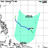
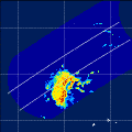
| Date/Time: | Mar 25,2010 04:41 (UTC) |
| Satellite/Sensor: | Aqua/AMSR-E |
| Path Number | 214MA |
| Lat/Lon: | 1.6N-21.1N
122.8E-140.0E |
| DownLoad: | P01B(V06) P2AP0(V06) P2WV0(V06) |
|
GSMaP |
 | | |  |  |
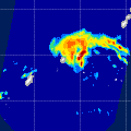
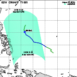
| Date/Time: | Mar 25,2010 16:54 (UTC) |
| Satellite/Sensor: | Aqua/AMSR-E |
| Path Number | 109MD |
| Lat/Lon: | 9.6N-29.1N
124.4E-142.3E |
| DownLoad: | P01B(V06) P2AP0(V06) P2WV0(V06) |
|
GSMaP |
 |  |  |  onClick='toggleDiv(event,this.src,"imageA");' onClick='toggleDiv(event,this.src,"imageA");' | |
|
GSMaP |
 |  |  |  onClick='toggleDiv(event,this.src,"imageA");' onClick='toggleDiv(event,this.src,"imageA");' | |
|
GSMaP |