| Observation Area | PR 3D | KuPR/PR/VIRS
Image | AMSR-E/AMSR
Precipitation | AMSR-E/AMSR
Total Precipitable Water | Information | GSMaP |
|---|
 |  |  |  onClick='toggleDiv(event,this.src,"imageA");' onClick='toggleDiv(event,this.src,"imageA");' |  |
|
GSMaP |
 | | |  |  |
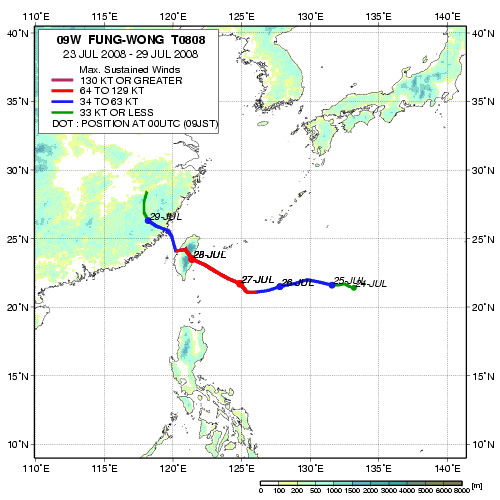
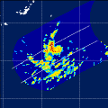
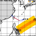
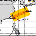
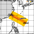
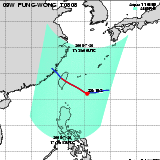
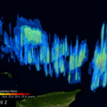
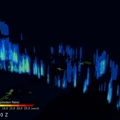
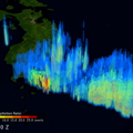
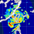
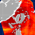
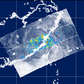
| Date/Time: | Jul 25,2008 16:52 (UTC) |
| Satellite/Sensor: | Aqua/AMSR-E |
| Path Number | 109MD |
| Lat/Lon: | 13.5N-33.0N
125.2E-143.7E |
| DownLoad: | P01B(V06) P2AP0(V06) P2WV0(V06) |
|
GSMaP |
 |  |  |  onClick='toggleDiv(event,this.src,"imageA");' onClick='toggleDiv(event,this.src,"imageA");' | |
|
GSMaP |
 |  |  |  onClick='toggleDiv(event,this.src,"imageA");' onClick='toggleDiv(event,this.src,"imageA");' | |
|
GSMaP |
 |  |  |  onClick='toggleDiv(event,this.src,"imageA");' onClick='toggleDiv(event,this.src,"imageA");' | |
|
GSMaP |
 | | | 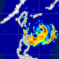 |  |
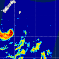
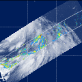
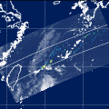
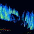
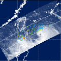
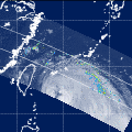
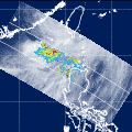
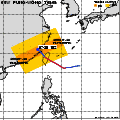
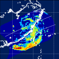
| Date/Time: | Jul 26,2008 17:35 (UTC) |
| Satellite/Sensor: | Aqua/AMSR-E |
| Path Number | 116MD |
| Lat/Lon: | 15.0N-34.5N
114.7E-133.4E |
| DownLoad: | P01B(V06) P2AP0(V06) P2WV0(V06) |
|
GSMaP |
 |  |  |  onClick='toggleDiv(event,this.src,"imageA");' onClick='toggleDiv(event,this.src,"imageA");' | |
|
GSMaP |
 |  |  |  onClick='toggleDiv(event,this.src,"imageA");' onClick='toggleDiv(event,this.src,"imageA");' | |
|
GSMaP |
 |  |  |  onClick='toggleDiv(event,this.src,"imageA");' onClick='toggleDiv(event,this.src,"imageA");' | |
|
GSMaP |
 | | |  |  |
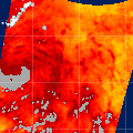
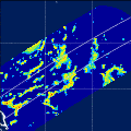
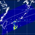
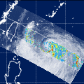
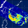
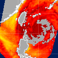
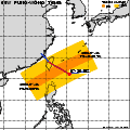
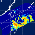
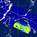
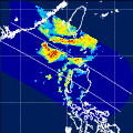
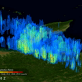
| Date/Time: | Jul 28,2008 05:13 (UTC) |
| Satellite/Sensor: | Aqua/AMSR-E |
| Path Number | 219MA |
| Lat/Lon: | 10.6N-30.1N
112.4E-130.5E |
| DownLoad: | P01B(V06) P2AP0(V06) P2WV0(V06) |
|
GSMaP |
 |  |  |  onClick='toggleDiv(event,this.src,"imageA");' onClick='toggleDiv(event,this.src,"imageA");' | |
|
GSMaP |