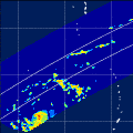
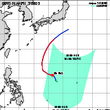
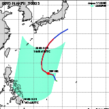
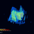
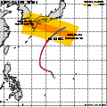
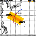
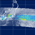
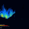
| Observation Area | PR 3D | KuPR/PR/VIRS
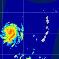
Image | AMSR-E/AMSR
Precipitation | AMSR-E/AMSR
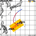
Total Precipitable Water | Information | GSMaP |
|---|
 |  |  |  onClick='toggleDiv(event,this.src,"imageA");' onClick='toggleDiv(event,this.src,"imageA");' |  |
|
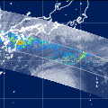
GSMaP |
 |  |  |  onClick='toggleDiv(event,this.src,"imageA");' onClick='toggleDiv(event,this.src,"imageA");' | |
|
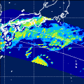
GSMaP |
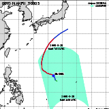 | | |  |  |
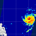
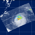
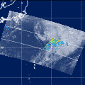
| Date/Time: | May 28,2008 04:02 (UTC) |
| Satellite/Sensor: | Aqua/AMSR-E |
| Path Number | 208MA |
| Lat/Lon: | 3.1N-22.5N
131.6E-149.0E |
| DownLoad: | P01B(V06) P2AP0(V06) P2WV0(V06) |
|
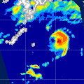
GSMaP |
 |  |  |  onClick='toggleDiv(event,this.src,"imageA");' onClick='toggleDiv(event,this.src,"imageA");' | |
|
GSMaP |
 | | |  |  |
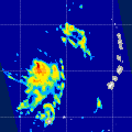
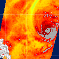
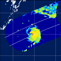
| Date/Time: | May 28,2008 16:16 (UTC) |
| Satellite/Sensor: | Aqua/AMSR-E |
| Path Number | 103MD |
| Lat/Lon: | 7.5N-26.9N
133.3E-151.0E |
| DownLoad: | P01B(V06) P2AP0(V06) P2WV0(V06) |
|
GSMaP |
 |  |  |  onClick='toggleDiv(event,this.src,"imageA");' onClick='toggleDiv(event,this.src,"imageA");' | |
|
GSMaP |
 | | |  |  |
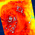
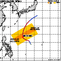
| Date/Time: | May 29,2008 04:46 (UTC) |
| Satellite/Sensor: | Aqua/AMSR-E |
| Path Number | 215MA |
| Lat/Lon: | 5.5N-24.9N
120.1E-137.7E |
| DownLoad: | P01B(V06) P2AP0(V06) P2WV0(V06) |
|
GSMaP |
 | | |  |  |
| Date/Time: | May 29,2008 16:58 (UTC) |
| Satellite/Sensor: | Aqua/AMSR-E |
| Path Number | 110MD |
| Lat/Lon: | 9.8N-29.2N
122.9E-140.9E |
| DownLoad: | P01B(V06) P2AP0(V06) P2WV0(V06) |
|
GSMaP |
 |  |  |  onClick='toggleDiv(event,this.src,"imageA");' onClick='toggleDiv(event,this.src,"imageA");' | |
|
GSMaP |
 | | |  |  |
| Date/Time: | May 31,2008 04:34 (UTC) |
| Satellite/Sensor: | Aqua/AMSR-E |
| Path Number | 213MA |
| Lat/Lon: | 5.4N-24.9N
123.2E-140.8E |
| DownLoad: | P01B(V06) P2AP0(V06) P2WV0(V06) |
|
GSMaP |
 |  |  |  onClick='toggleDiv(event,this.src,"imageA");' onClick='toggleDiv(event,this.src,"imageA");' | |
|
GSMaP |
 | | |  |  |
| Date/Time: | May 31,2008 16:45 (UTC) |
| Satellite/Sensor: | Aqua/AMSR-E |
| Path Number | 108MD |
| Lat/Lon: | 13.4N-32.9N
126.7E-145.2E |
| DownLoad: | P01B(V06) P2AP0(V06) P2WV0(V06) |
|
GSMaP |
 |  |  |  onClick='toggleDiv(event,this.src,"imageA");' onClick='toggleDiv(event,this.src,"imageA");' | |
|
GSMaP |
 |  |  |  onClick='toggleDiv(event,this.src,"imageA");' onClick='toggleDiv(event,this.src,"imageA");' | |
|
GSMaP |
 |  |  |  onClick='toggleDiv(event,this.src,"imageA");' onClick='toggleDiv(event,this.src,"imageA");' | |
|
GSMaP |
 |  |  |  onClick='toggleDiv(event,this.src,"imageA");' onClick='toggleDiv(event,this.src,"imageA");' | |
|
GSMaP |
 | | |  |  |
| Date/Time: | Jun 02,2008 04:24 (UTC) |
| Satellite/Sensor: | Aqua/AMSR-E |
| Path Number | 211MA |
| Lat/Lon: | 12.7N-32.2N
124.0E-142.4E |
| DownLoad: | P01B(V06) P2AP0(V06) P2WV0(V06) |
|
GSMaP |
 |  |  |  onClick='toggleDiv(event,this.src,"imageA");' onClick='toggleDiv(event,this.src,"imageA");' | |
|
GSMaP |
 | | |  |  |
| Date/Time: | Jun 02,2008 16:30 (UTC) |
| Satellite/Sensor: | Aqua/AMSR-E |
| Path Number | 106MD |
| Lat/Lon: | 23.1N-42.6N
131.6E-152.1E |
| DownLoad: | P01B(V06) P2AP0(V06) P2WV0(V06) |
|
GSMaP |
 |  |  |  onClick='toggleDiv(event,this.src,"imageA");' onClick='toggleDiv(event,this.src,"imageA");' | |
|
GSMaP |
 |  |  |  onClick='toggleDiv(event,this.src,"imageA");' onClick='toggleDiv(event,this.src,"imageA");' | |
|
GSMaP |
 |  |  |  onClick='toggleDiv(event,this.src,"imageA");' onClick='toggleDiv(event,this.src,"imageA");' | |
|
GSMaP |