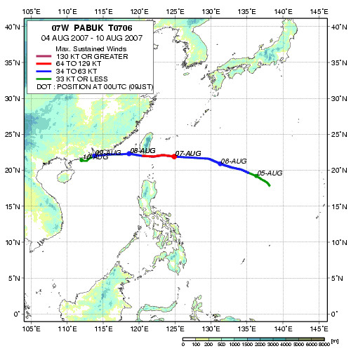
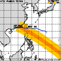
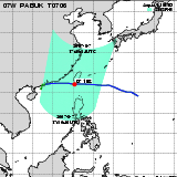
| Observation Area | PR 3D | KuPR/PR/VIRS
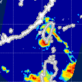
Image | AMSR-E/AMSR
Precipitation | AMSR-E/AMSR
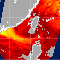
Total Precipitable Water | Information | GSMaP |
|---|
 |  |  |  onClick='toggleDiv(event,this.src,"imageA");' onClick='toggleDiv(event,this.src,"imageA");' |  |
|
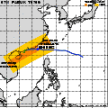
GSMaP |
 |  |  |  onClick='toggleDiv(event,this.src,"imageA");' onClick='toggleDiv(event,this.src,"imageA");' | |
|
GSMaP |
 | | |  |  |
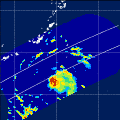
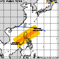
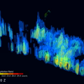
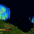
| Date/Time: | Aug 06,2007 04:53 (UTC) |
| Satellite/Sensor: | Aqua/AMSR-E |
| Path Number | 216MA |
| Lat/Lon: | 8.2N-27.6N
117.8E-135.6E |
| DownLoad: | P01B(V05) P2AP0(V05) P2WV0(V05) |
|
GSMaP |
 |  |  |  onClick='toggleDiv(event,this.src,"imageA");' onClick='toggleDiv(event,this.src,"imageA");' | |
|
GSMaP |
 |  |  |  onClick='toggleDiv(event,this.src,"imageA");' onClick='toggleDiv(event,this.src,"imageA");' | |
|
GSMaP |
 | | |  |  |
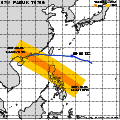
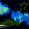
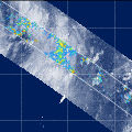
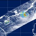
| Date/Time: | Aug 06,2007 17:02 (UTC) |
| Satellite/Sensor: | Aqua/AMSR-E |
| Path Number | 111MD |
| Lat/Lon: | 14.8N-34.3N
122.3E-141.0E |
| DownLoad: | P01B(V05) P2AP0(V05) P2WV0(V05) |
|
GSMaP |
 |  |  |  onClick='toggleDiv(event,this.src,"imageA");' onClick='toggleDiv(event,this.src,"imageA");' | |
|
GSMaP |
 |  |  |  onClick='toggleDiv(event,this.src,"imageA");' onClick='toggleDiv(event,this.src,"imageA");' | |
|
GSMaP |
 | | |  |  |
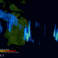
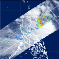
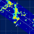
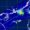
| Date/Time: | Aug 07,2007 17:45 (UTC) |
| Satellite/Sensor: | Aqua/AMSR-E |
| Path Number | 118MD |
| Lat/Lon: | 16.0N-35.5N
111.8E-130.6E |
| DownLoad: | P01B(V05) P2AP0(V05) P2WV0(V05) |
|
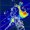
GSMaP |
 |  |  |  onClick='toggleDiv(event,this.src,"imageA");' onClick='toggleDiv(event,this.src,"imageA");' | |
|
GSMaP |
 |  |  |  onClick='toggleDiv(event,this.src,"imageA");' onClick='toggleDiv(event,this.src,"imageA");' | |
|
GSMaP |