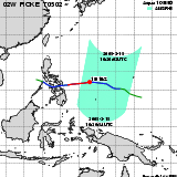
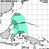
| Observation Area | PR 3D | KuPR/PR/VIRS
Image | AMSR-E/AMSR
Precipitation | AMSR-E/AMSR
Total Precipitable Water | Information | GSMaP |
|---|
 |  |  |  onClick='toggleDiv(event,this.src,"imageA");' onClick='toggleDiv(event,this.src,"imageA");' |  |
|
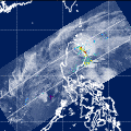
GSMaP |
 |  |  |  onClick='toggleDiv(event,this.src,"imageA");' onClick='toggleDiv(event,this.src,"imageA");' | |
|
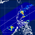
GSMaP |
 |  |  |  onClick='toggleDiv(event,this.src,"imageA");' onClick='toggleDiv(event,this.src,"imageA");' | |
|
GSMaP |
 | | |  |  |
| Date/Time: | Mar 15,2005 04:10 (UTC) |
| Satellite/Sensor: | Aqua/AMSR-E |
| Path Number | 210MA |
| Lat/Lon: | 1.3S-18.1N
129.8E-146.8E |
| DownLoad: | P01B(V03) P2AP0(V03) P2WV0(V03) |
|
GSMaP |
 | | | 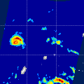 |  |
| Date/Time: | Mar 15,2005 16:26 (UTC) |
| Satellite/Sensor: | Aqua/AMSR-E |
| Path Number | 105MD |
| Lat/Lon: | 4.3N-23.7N
129.5E-146.9E |
| DownLoad: | P01B(V03) P2AP0(V03) P2WV0(V03) |
|
GSMaP |
 | | |  |  |
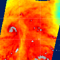
| Date/Time: | Mar 16,2005 04:53 (UTC) |
| Satellite/Sensor: | Aqua/AMSR-E |
| Path Number | 217MA |
| Lat/Lon: | 1.7S-17.7N
119.1E-136.1E |
| DownLoad: | P01B(V03) P2AP0(V03) P2WV0(V03) |
|
GSMaP |
 |  |  |  onClick='toggleDiv(event,this.src,"imageA");' onClick='toggleDiv(event,this.src,"imageA");' | |
|
GSMaP |
 |  |  |  onClick='toggleDiv(event,this.src,"imageA");' onClick='toggleDiv(event,this.src,"imageA");' | |
|
GSMaP |
 |  |  |  onClick='toggleDiv(event,this.src,"imageA");' onClick='toggleDiv(event,this.src,"imageA");' | |
|
GSMaP |