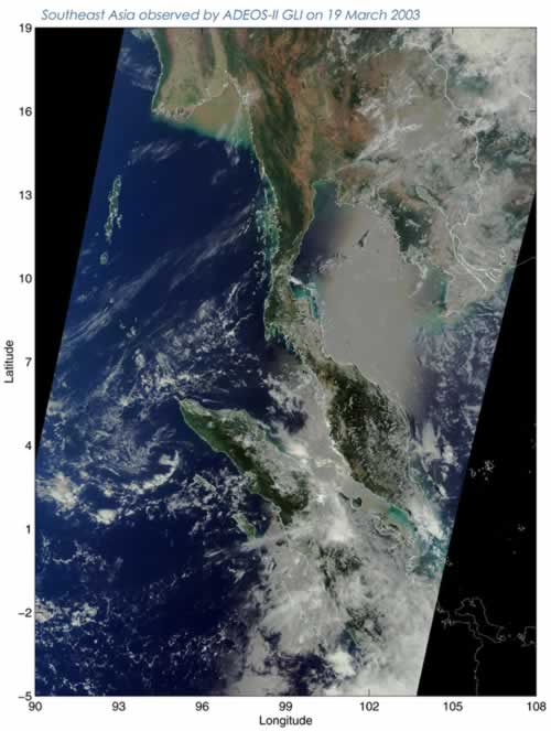
This image shows Southeast Asia, from Thailand and Malaysia to Sumatera Island (Indonesia) as observed by
GLI on 19 March 2003. The dense vegetation of the tropical rainforests in the Malay Peninsula and Sumatera Island was captured. You can also recognize the mouth of the Irrawaddy River in the western base of the peninsula (south of Myanmar) where earth and sand from the Irrawaddy River flow into the shallows of the Andaman Sea and the sea water is becoming turbid.
Urban areas of Bangkok and vegetation along the Chao Phraya River in the eastern base of the peninsula can be seen clearly. Tonle Sap Lake, the largest lake in Southeast Asia, and the neighboring vegetation can also be seen beneath the clouds about 400km south of Bangkok (
GLI observation region (east-west) 1600km). The season in this area is now changing from rainy to dry, so the water level of the lake will start to rise and the lake area will grow to about 10,000 square kilometers, almost four times its present size (about 15 times as large as Lake Biwa) in the most swollen period during the rainy season. The sea from the Gulf of Siam to the Strait of Malacca appears white due to reflection of sunlight on the sea surface known as sunglitter. The white water of the Tonle Sap is due to the same phenomenon.