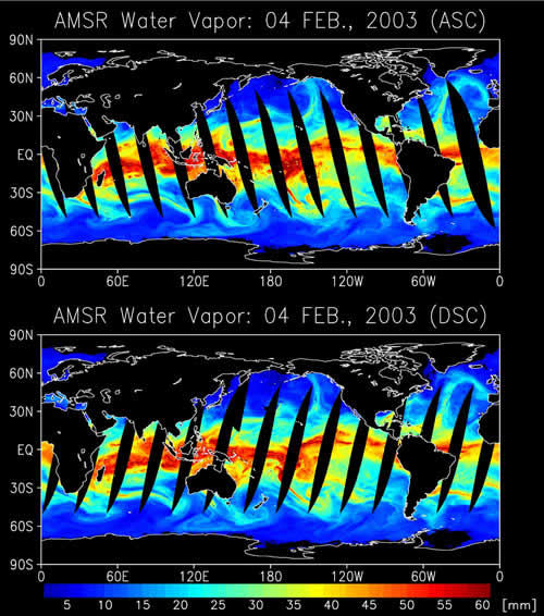
These images show the global water vapor distribution estimated by
AMSR data acquired on February 4, 2003. The upper image shows observations around 10:30 p.m. local time, and the lower image 10:30 a.m. Moist atmosphere clearly intruded into high latitudes along with cyclones or fronts. The amount and distribution of water included in the atmosphere, such as water vapor and rainfall, have very large variability both temporally and spatially, and the variation is closely related to our daily life.
AMSR is one of highest horizontal resolution microwave radiometers. Detailed information of water vapor and rainfall provided by
AMSR is thus expected to improve the accuracy of numerical weather predictions through models. Furthermore, operating
AMSR with
AMSR-E, a sister sensor developed by NASDA with
AMSR and flown aboard NASA's Aqua satellite, increases the observation cycle and coverage over the entire globe, and much more information will become available. These data are processed with the
AMSR standard algorithm, and we will start validating products processed continuously by using ground observation data.
 » go to AMSR/AMSR-E Product & Algorithm page