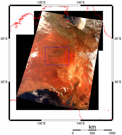
The upper left image shows a segment of a
GLI pass over the central part of the Australian continent, acquired with 250 metres ground resolution. The image covers the Gulf of Carpentaria in the north and some distributed vegetation in the Northern Territory and Queensland. The central part of the image is dominated by arid land; the Simpson Desert, Alice Springs, the Great Artesian Basin and the Macdonnel Range, stretching down through South Australia over the Lake Eyre Basin to Adelaide on the coast.
The image is a so called true color composite, which renders colors similar to those as seen by the human eye, generated by displaying
GLI spectral channel 22 (660 nm) in red, channel 21 (545 nm) in green and channel 20 (460 nm) in blue.
The image was acquired at 10:00 (JST) on February 6, during the second check-out period for
GLI. The data were recorded using the on-board Optical-disk Data Recorder (ODR), which is an experimental high data-rate, high capacity Magneto-Optical data storage device. The ODR allows ADEOS-II to acquire and store large data volume also over areas which cannot be transmitted directly to the ground receiving station in Japan.
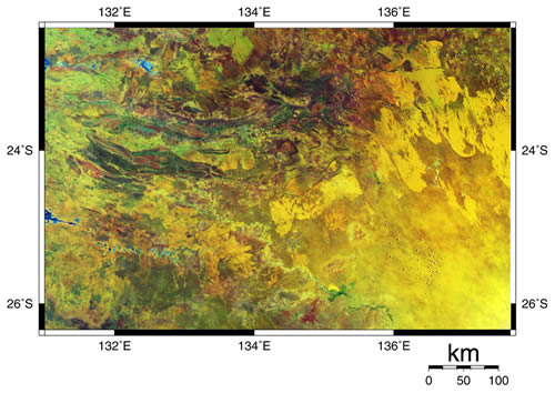
Areas appearing yellow-green or brown are generally sedimentary rock, which rich in iron oxide. The blue or blue-green parts in east-west direction are mainly carbonate rocks, while green typically indicates vegetation. The yellowish Simpson Desert covers the south-eastern part of the image, with sand dunes identifiable by their linear appearance. A
GLI ground validation site is maintained close to Alice Springs for calibration and validation of the
GLI instrument.
This image was derived by using spectral channels 29 (2210 nm), 23 (825 nm) and 20 (460 nm), corresponding to short-wave infrared, near-infrared and blue, respectively. This channel combination is often used for geological resources survey, and equivalent to the Landsat TM bands 7, 4, 1 assignment.
The
GLI sensor is designed for frequent global monitoring, and with 6 channels at 250 metre resolution, it is well adapted for characterisation of the Earth's surface, its vegetation and soils.